Artec’s New “Jet” 3D Scanner Digitizes Entire Sites via Drone-Mounted or Handheld LiDAR

Forget stationary tripods and GPS limits: Artec 3D’s first SLAM-based mobile mapping system delivers rapid digital twins of almost any environment.
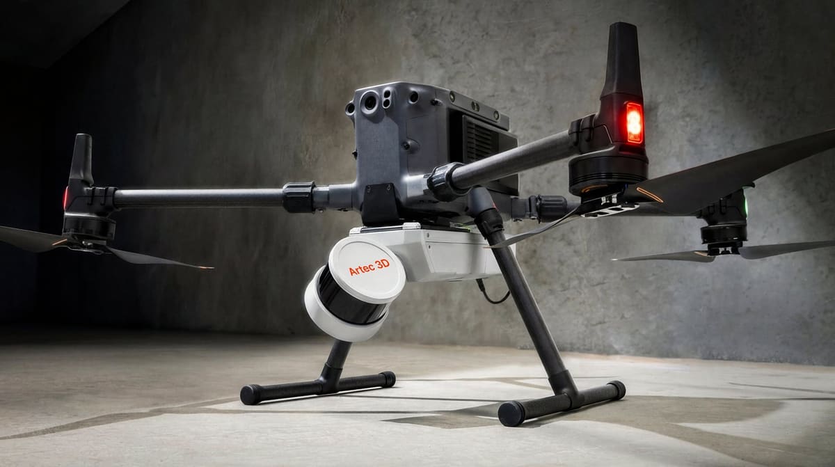
Artec 3D just launched the Artec Jet, a 3D scanner that’s a new direction for the company. It’s designed to quickly create detailed 3D models of large environments, whether it’s a factory floor, construction site, or even an underground tunnel.
Unlike traditional 3D scanners — and Artec’s other models — that are often used on smaller objects, Artec Jet is built to capture entire spaces while moving, making it part of a growing category of “mobile mapping” systems. Technically it’s a SLAM (Simultaneous Localization and Mapping)-based LiDAR system that builds a map of an environment and figure sout its own position within that map at the same time, using a LiDAR (Light Detection and Ranging) sensor.
Mobile 3D scanning systems like Artec Jet are becoming more common as industries look for faster ways to digitize real-world environments. While they don’t replace high-precision tools in every case, they offer a practical way to capture large spaces quickly and turn them into usable digital models.
Artec Jet follows this trend, combining established scanning technology with flexible deployment options, most notably mounted on a drone, for a wide range of real-world applications.

Turning Real-World Spaces Into 3D Models
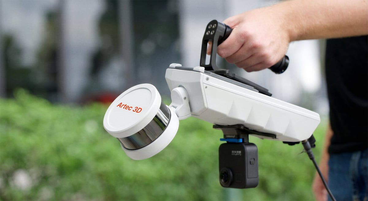
Artec Jet enables users to scan large areas without needing GPS or setting up equipment in one place. The scanner can be used in multiple ways—held in the hand, worn as a backpack, mounted on a vehicle, or, as mentioned, attached to a drone.
This means it can work:
- Indoors (like warehouses or offices)
- Outdoors (construction sites, infrastructure)
- Underground (mines, tunnels)
Artec Jet is designed to balance speed and detail, the company says. According to its specifications:
- It can scan objects up to 300 meters away
- It collects up to 1.9 million measurement points per second
- It captures a full 360° view around the user
- In terms of precision, it can typically measure within about 1 to 1.5 centimeters, which is standard for this type of mobile scanning system.
For very high-precision engineering work, slower, tripod-based scanners are still commonly use, but mobile systems like this are valued for how quickly they can cover large areas.
Scanning with Drones and Assisted Navigation
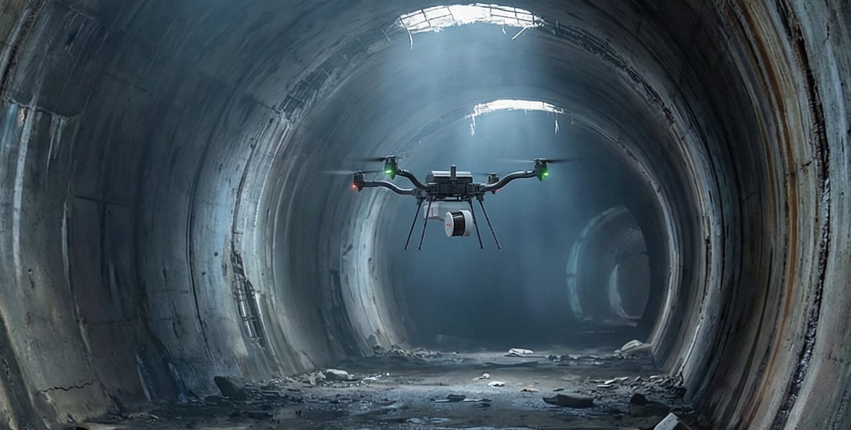
One of Artec Jet’s key features is that it can be mounted on a drone. In that setup, the system can follow pre-planned routes or assist with navigation while avoiding obstacles, depending on the drone platform.
This is especially useful in places that are difficult or unsafe for people to access, such as damaged structures, industrial facilities, or disaster zones.
Similar capabilities are already found in systems like Emesent Hovermap, which is widely used in mining and inspection work.
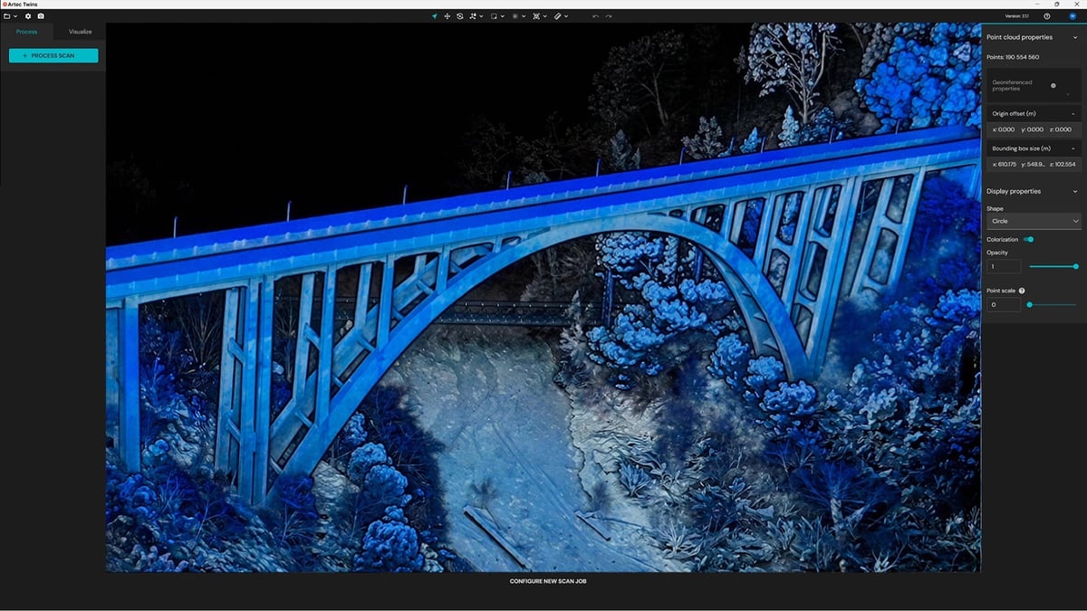
Processing the Data: Artec Twins
To handle the large amount of data collected, Artec also launched new software called Artec Twins. It allows users to:
- Combine multiple scans into one model
- View and inspect the data
- Export files for use in design or engineering tools
The software reflects a broader trend in the industry, where hardware and software are designed to work together as a single workflow.

Artec Jet enters a market that already includes several well-known mobile scanning solutions, including, NavVis VLX, a larger, wearable system for scanning buildings and facilities, and drone mounted options like DJI Zenmuse series, Riegl YellowScan, and Rock Robotic.
According to Artec, what sets the Jet apart from the competition is its combination of longer scanning range (up to 300 m), multiple ways to deploy it (handheld, drone, vehicle), and integration into Artec’s existing 3D scanning lineup.
With this launch, Artec expands beyond its object-level scanning into full-site capture, complementing devices like the Artec Leo and Artec Ray II.
Tech Specs
Accuracy depends on environmental factors.
You May Also Like:


License: The text of "Artec’s New “Jet” 3D Scanner Digitizes Entire Sites via Drone-Mounted or Handheld LiDAR" by All3DP Pro is licensed under a Creative Commons Attribution 4.0 International License.