The Best Free Photogrammetry Software

Check out our picks for the best free photogrammetry software, from on-the-go mobile apps to fully-fledged point cloud editing tools!
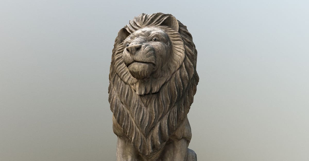
Photogrammetry is the process of obtaining reliable data on real-world objects from photos.
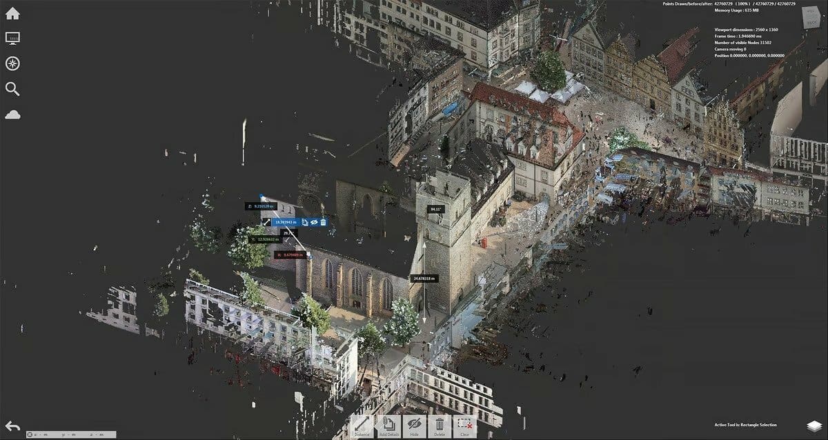
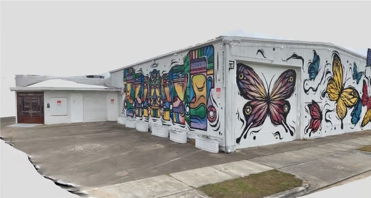
2D and 3D data is extracted from an image and, with overlapping photos of an object, building, or terrain, converted into a digital 3D model. This allows for capturing large things, even landscapes that would otherwise be impossible to scan. As such, surveyors, architects, engineers, and contractors often use photogrammetry to create topographic maps, networks, or point clouds.
Photogrammetry software comes in many shapes and forms. Commercial solutions are ideal for industrial and engineering applications, but robust apps and programs are available for free. You only need a camera or phone to take pictures. If you have access to a 3D printer, you can even print your models afterward!
In this article, we’ve compiled a list of the best photogrammetry software, but first, let’s take a closer look at how these programs work.

Types of Photogrammetry
Photogrammetry software automatically registers shared points between multiple images and calculates their distances in 3D space. This process results in a point cloud that can be further transformed into a 3D mesh. Usually, more photos equal better model quality. Some advanced programs may offer tools to refine the point cloud, improving the quality of the mesh.
A sufficient amount of image data is crucial to ensure the accuracy of photogrammetry software. There are two primary techniques used: structure from motion (SfM) and coded markers. The SfM method relies on distinctive features in the images to establish correspondences between them and then extrapolate the 3D structure.
Coded markers are small, two-dimensional markers that are applied to the surface of an object with poor features or reflective and transparent surfaces before the object is scanned. These patterned markers provide a reference point for the photogrammetry software. When used correctly, coded markers can be more accurate than the structure from the motion technique.
While most photogrammetry software focuses on generating high-quality 3D meshes or point clouds, some programs also incorporate analysis tools within their workspace. These additional features allow users to perform measurements, annotate maps, or enrich the data. Infrastructure companies, forestry agencies, and coast-line management organizations frequently utilize such solutions.
The typical setup for photogrammetry involves a handheld camera or a tripod-mounted camera for added stability. This approach, known as terrestrial photogrammetry, captures street-level imagery and is suitable for scanning small-scale objects.
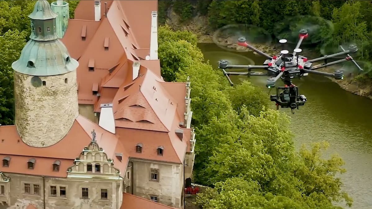
Aerial photogrammetry involves the installation of a camera on an aircraft to capture images of expansive structures like buildings, mountains, or cities. A high-quality model requires hundreds or thousands of photos and an 80-90% overlap.
With all that said, let’s dive into the best free options out there to help you get started capturing stunning features.
Meshroom
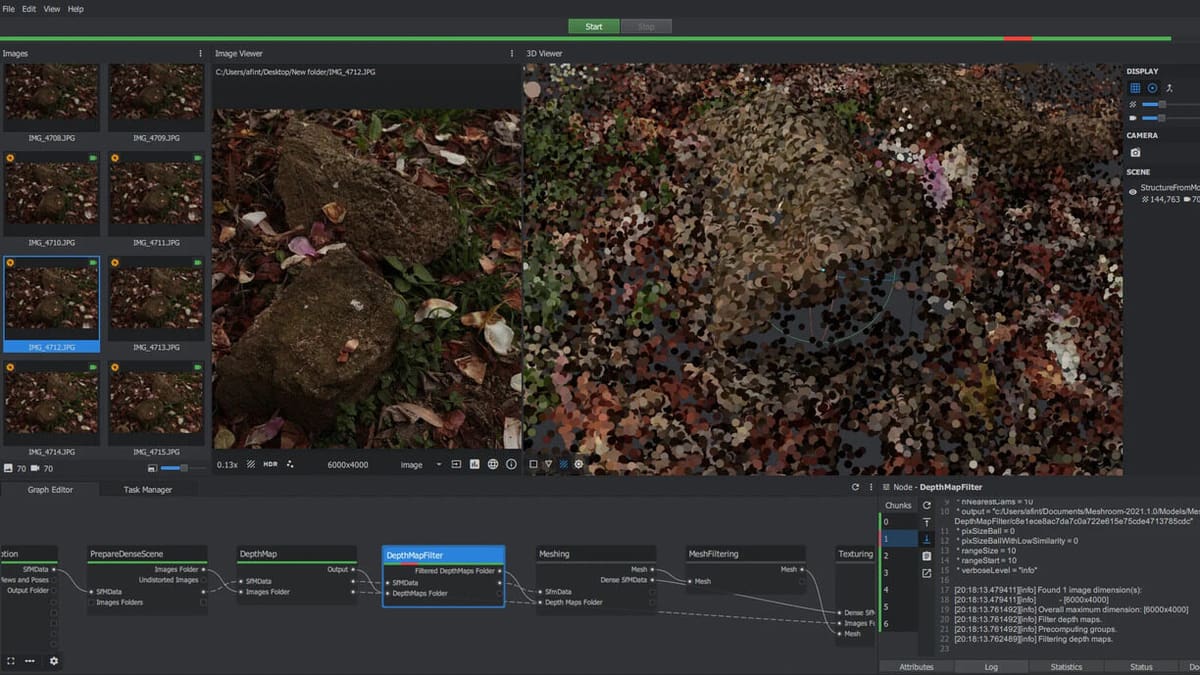
Meshroom is a free, open-source photogrammetry software based on the AliceVision framework. With it, you can generate a 3D model using images of an object from different angles. The software calculates the distance between surface points and creates an object mesh.
The program is built around an easy-to-use, node-based workflow that connects all the steps to generate a 3D model. These would have to be activated individually in other programs, but since they form one pipeline of nodes in Meshroom, it’s one click.
But what’s the point of having this elaborate pipeline when all you need is one button? Each node can be tweaked to get exactly the desired result. For example, choose the texture node to set the resolution of the texture map to fit the application, from mobile gaming to high-res rendering. The more time you invest in this free photogrammetry software, the better your results will be.
If you’re an Autodesk Maya user, you can install a free Meshroom plug-in from the website to use the software directly inside the 3D modeler. Alternatively, there are easy exporting options for Blender or Unity.
- Compatible OS: Windows, Linux
- Output file formats: .obj, .ply
- Software: AliceVision
Kiri Engine
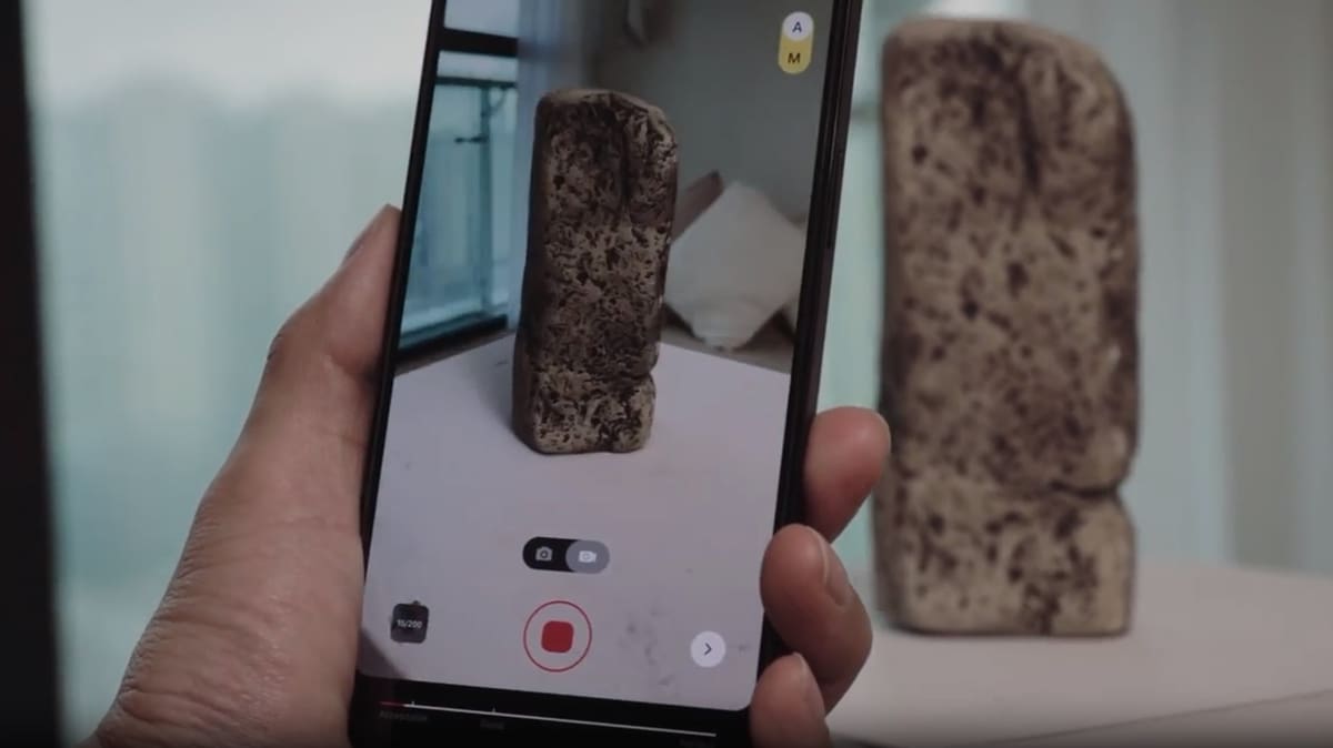
While iOS users have some variety in photogrammetry apps, Android owners are much more limited in their choices. Kiri Engine, we reckon, is one of the few free services out there that provide decent results when using Android phones.
There’s also the option to use the web interface, so you don’t even need a phone! Using Kiri Engine on a web browser is quite simple, allowing you to upload images from a DSLR for even better reconstruction.
The app is free to download, but you must use tokens to export any scanned models. These tokens let you access unlimited downloads of one scanned model. You get three of these tokens, which reset every week. You’re also limited to 70 photos per model. The premium version is about $60 annually or $15 monthly. It gives you unlimited exports, advanced camera settings, the web interface, and up to 200 photos per model.
- Compatible OS: iOS, Android, but also browser-based
- Output file formats: .obj, .stl, .fbx, .gltf, .glb, .usdz, .ply, .xyz
- Software: Kiri Engine, App Store, Google Play
Polycam
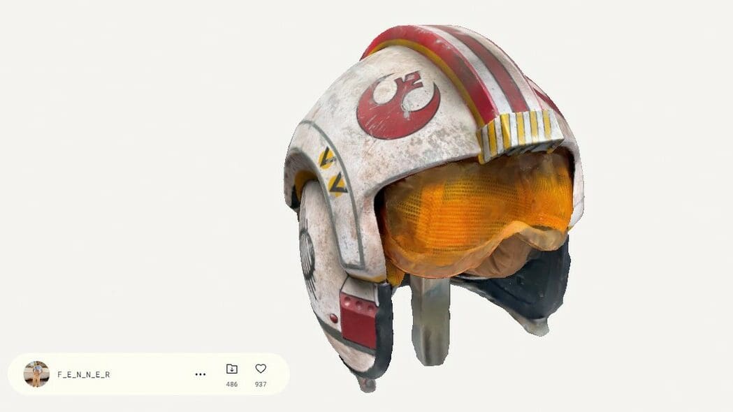
Polycam is a popular 3D scanning app that’s available for iOS and Android. The iOS version allows for Lidar scanning, if the mobile device is equipped with it. Similar to Kiri Engine, Polycam also has a photogrammetry option on their website that’s free to use.
On the website, 20 to 150 JPG or PNG images can be imported for photogrammetry. Alternatively, a MP4, MOV, AVI, or M4V video that’s 0:15-3:00 minutes in length can be utilized. Similarly, the app has a Photo Mode that allows 25-200 photos to be taken, which are then uploaded to a computer by Polycam and processed.
While you can take as many scans as you want with the free app, there are some limits to Polycam. Only one scan can be exported per week with the free account. The online photogrammetry tool is also limited, permitting only 250 captures. Nevertheless, Polycam is a great tool, thanks to its quick and easy scans as well as multiple adjustment settings to get the desired results.
If more functionality is desired, you can buy a Pro subscription for about $100 annually or $18 monthly. With a Pro account, up to 2,000 images can be used with the photogrammetry tool, or 1,000 in Photo Mode. Additionally, an unlimited number of models can be downloaded.
- Compatible OS: iOS and Android, but also browser-based
- Output file formats: .obj, .glb, .fbx, .dae, .stl and .usdz for mesh data; .dxf, .ply, .laz, .xyz and .pts. for point cloud data
- Software: Polycam, App Store, Google Play
3DF Zephyr Free
For beginners looking for free photogrammetry software to try out, 3DF Zephyr is a great option. It has a helpful UI, a good amount of community support, and tutorials, differentiating it from some of the more professional options on this list that have a steep learning curve.
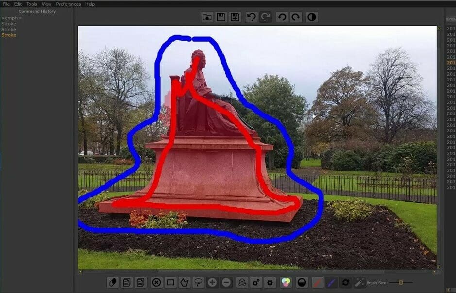
3DF Zephyr has multiple versions available for download, including a free version. Although only 50 images can be uploaded for creating a mesh, the free version is still great for reconstructing small objects. Additionally, there are some editing tools available, such as the masking tool, which help refine the finished product.
If 50 images is too limited for you, 3DF Zephyr Free can be upgraded to the Lite version for a one time fee of $205. With this version, an unlimited number of photos can be used for recreating objects and more editing tools are unlocked.
- Compatible OS: Windows
- Output file formats: .ply, .obj, .mtl, but more options available with paid versions
- Software: 3D Flow
PhotoCatch
PhotoCatch is one of the first apps based on Apple’s Object Capture API, available on MacOS Monterey and above. It allows you to create scans of 3D objects with your iPhone or iPad with a straightforward, user-friendly process that takes only a few minutes.
However, beware that compiling the data requires a Mac with an M1 chip or an Intel Mac with 16 GB of RAM and an AMD GPU with at least 4 GB VRAM. If you don’t possess this firepower, PhotoCatch also works from mobile iOS devices.
The community feedback is overwhelmingly positive, and even users that are completely new to photogrammetry report that they can create successful scans. If you fulfill the hardware requirements or don’t mind dishing out a few dollars to do the computing in the cloud, try this one.
The app is free to download, but depending on the number of uploaded images, one model will start around $2. There are also Essentials and Pro bundles for around $5 and $10 per month, respectively. PhotoCatch also supports direct export to Sketchfab, where many models are showcased and available for download.
- Compatible OS: MacOS, iOS
- Output file formats: .obj, .usdz
- Software: App Store
OpenMVG

OpenMVG is a library targeted at photogrammetry that’s popular with computer-vision scientists and within the Multiple View Geometry (MVG) community. MVG is the mathematics of reconstructing the “three-dimensional world and camera motion from multiple images“. Not only can the 3D structure of objects be gleaned from the correspondences between images, but also the position and motion of the cameras used to photograph the objects.
OpenMVG focuses on the SfM photogrammetry technique, with several integrated tools built around it. All its features and models are tested to ensure they work properly in real-life situations.
This photogrammetry pipeline requires compiling and takes some computer savvy to get up and running. Still, the community-focused accessibility of OpenMVG makes it a convenient tool that fits into the workflows of other photogrammetry tools.
- Compatible OS: Windows
- Output file formats: .json, .bin, .xml, .ply, .baf
- Software: GitHub
MicMac
MicMac is a free, open-source photogrammetry software developed by the French National Geographic Institute and the French National School of Geographic Sciences. Its sophisticated feature set is mainly suited to professional or academic users, but hobbyists may find it interesting as well.
As a product of consistent teaching experience and research, MicMac has proven itself a versatile tool successfully used in cartography, environmental protection, forestry, cultural heritage preservation, and private industries to generate 3D models and orthographic images.
This photogrammetry software can also handle any object and scale you throw at it. It’s just as capable of surveying large plots of land as well as small objects. In addition, it can process close-range images and aerial footage. Some of the editing tools provided even make it a feasible solution for metrology and site surveying. There are many online tutorials out there that can help you get started with this program.
- Compatible OS: Windows, MacOS, Ubuntu, Raspberry Pi
- Output file formats: .geotiff, .ply, .xml
- Software: GitHub
COLMAP
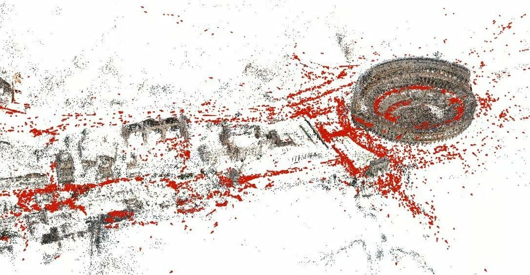
COLMAP is a free photogrammetry software available for download from GitHub. You can run it from the command line or with a GUI. Like most other photogrammetry software, COLMAP can reconstruct 3D objects automatically from single-camera or stereo setups.
As it’s a program created by researchers, COLMAP also includes many highly advanced options. These are not mandatory for users who want to generate a quick and easy 3D mesh, but they can enhance the quality. For example, you can extensively define the type of camera used to capture the imagery. The same applies to the feature extraction process that can be tweaked for the best possible results.
Although the program can export a 3D mesh, you can only work with the dense point cloud viewport. To clean up and refine the 3D mesh, you must work with other programs like MeshLab.
- Compatible OS: Windows, MacOS, Linux
- Output file formats: .ply, .vrml
- Software: GitHub
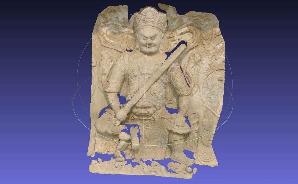
Regard3D
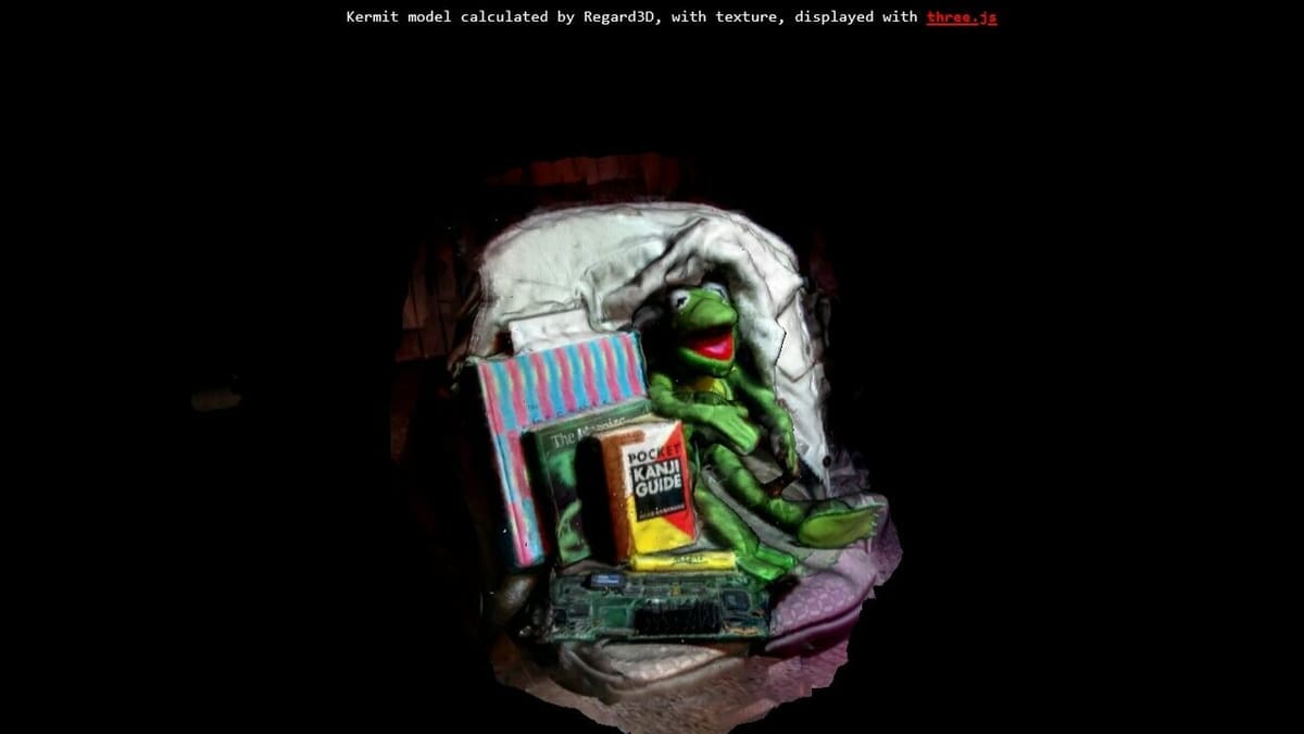
Regard3D is a free and open-source photogrammetry software that uses the structure-from-motion method to convert photos of an object from various angles into a 3D model. It offers an extensive toolset for editing the point cloud, either with colored vertices or a texture, before generating a 3D mesh.
It may take a while to settle in and get comfortable with all the settings and parameters you can adjust in Regard3D before achieving the desired results. Still, even if you are new to photogrammetry software, this is a great place to begin: Regard3D’s website offers all the guides and tutorials you need to get started quickly.
- Compatible OS: Windows, MacOS
- Output file formats: .obj, .ply
- Software: Regard3D
VisualSFM
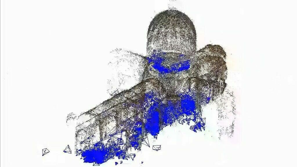
As indicated by its name, VisualSFM is a photogrammetry software that uses the structure-from-motion method to generate point clouds. Users can choose between working with the command line or a GUI. The program can detect and match features and adjust bundles.
Built by Changchang Wu, a software engineer at Google, VisualSFM is part of Wu’s research and others in the field. Although die-hard photogrammetry fans can go nuts with dozens of parameter settings to tweak the results, creating a basic point cloud in VisualSFM requires no more than four button clicks. Please note that this program is only free for personal, non-profit, or educational use.
- Compatible OS: Windows, MacOS, Linux
- Output file formats: .ply
- Software: VisualSFM
License: The text of "The Best Free Photogrammetry Software" by All3DP is licensed under a Creative Commons Attribution 4.0 International License.