Our 10 Favorite Photogrammetry Software Tools & How to Pick the Right One

Check out our choice of photogrammetry software available right now for virtual reality, gaming, mapping, construction, drones, defense, and so much more!
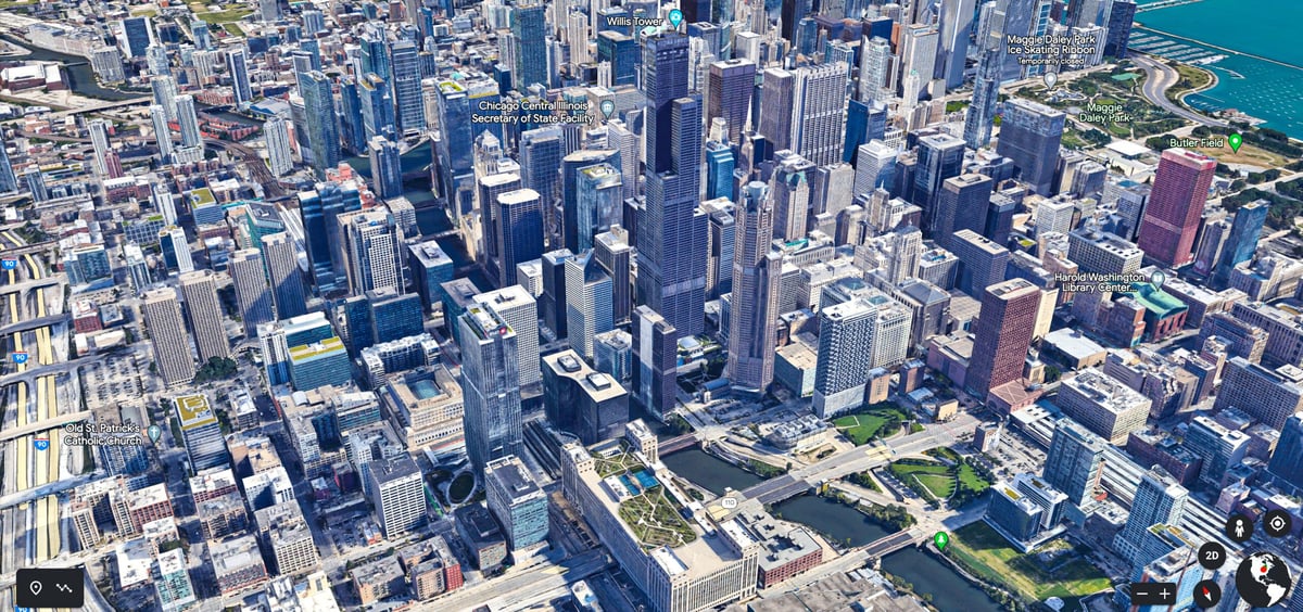
If you’ve ever explored foreign cities with Google Earth or played Fortnite, you’ve experienced the benefits of photogrammetry — using photographs to measure and map objects and spaces.
By combining multiple aerial photos along with elevation and topography information from NASA, Google Earth creates realistic 3D views of most major cities. Similarly, video game maker Epic Games uses photogrammetry to give its games a more realistic look in a fraction of the time it would take to design a similar 3D environment from scratch.
Photogrammetry is arguably more popular than ever, used in all types on online and virtual environments for everything from monitoring real estate construction and analyzes forest canopies, to making virtual tours to major motion pictures more realistic. It’s used to make 3D models of people and things for online shopping, but is most suited for modeling terrains, landscapes, and places that would otherwise be difficult or impossible to 3D scan.
With the proliferation of aerial drones, there’s no limit to the uses for photogrammetry by surveyors, architects, engineers, and even consumers.
Besides landscapes and building sites, photogrammetry is also becoming a really economical way to scan objects with smartphones using apps like Kiri Engine. Since almost everyone now has an effective 3D model maker in their pocket (i.e. their phone camera), retailers are incorporating customer self-scanning to offer virtual try-on of eyewear and clothes. Video game makers are enabling players to scan themselves into games as characters.
Almost any device that can take a picture can be used to create a 3D model through photogrammetry, but its the software that does the heavy lifting. Your app options today vary significantly in features, speed, price,and overall quality. While we’ve covered the free photogrammetry solutions for desktop and mobile phone apps in other guides, here, we focus on the professional solutions, their key features, and what they’re used for.
| Name | Type | OS | Price | Target Industries |
|---|---|---|---|---|
| Autodesk ReCap Pro 2027 | Aerial, Close-Range | Windows | $50/month, $405/year | Architecture, Engineering, Construction |
| Metashape | Aerial, Close-Range | Windows, MacOS, Linux | Standard $179; Pro $3,499 perpetual licenses | Construction, Agriculture, Forestry, Oil & Gas, Mining, 3D Model Generation, Surveying |
| RealityScan 2.2 | Aerial, Close-Range | Windows | Free for personal/educational use; $1,250/year | Architecture, Surveying, Gaming, Cultural Heritage, Virtual Reality, 3D Printing |
| 3DF Zephyr (9.0) | Aerial, Close-Range | Windows | Limited free version, Lite $229 perpetual, Full $288/month or $4,830 perpetual | Surveying, Mining, Construction, Gaming, Engineering, Agriculture, Architecture, Manufacturing |
| Bentley iTwin Capture WorkSuite | Aerial, Close-Range | Windows, Linux | Free to start with iTwin Capture Modeler Flex; pay only when you process with iTwin Capture Engine | Bridges & Transport, Water & Utilities, Construction, Surveying, Mining |
| Correlator3D | Aerial | Windows | From ~$3,000/year | Surveying, Mining, Construction, Agriculture, Forestry, Emergency Response |
| DroneDeploy | Aerial | Windows, macOS, Android, iOS | Individual Pilot plan from $4,188/year; Ag Lite plan from $1,908/year; team and enterprise pricing by custom quote | Construction, Agriculture, Roofing, Oil & Gas, Mining, Property Management, Utilities |
| Imagine Photogrammetry | Aerial | Windows | On request | Surveying, Mapping, Defense |
| Photomodeler | Aerial, Close-Range | Windows | $68/month Standard, $118/month Premium | Marine, Forensics, Manufacturing, Surveying |
| WebODM | Aerial | Windows, macOS | Free version or $57 | Surveying, Agriculture, Mining, Property Management, Utilities |
What to Look for in Photogrammetry Software
To know what features you need in photogrammetry software, you’ll need to understand how exactly it works.
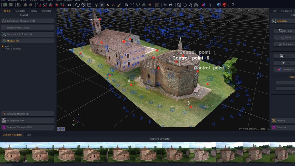
Using photos as the source of data, the program automatically recognizes the shared points between every image and calculates the distances between them in 3D space. The result is a point cloud that you can transform into a 3D mesh. Some more advanced programs also provide tools for cleaning up the point cloud to enhance the overall quality.
Photogrammetry is generally not considered as accurate as laser or structured light 3D scanners, but is often the only solution for large areas. Where photogrammetry shines over 3D scanning is in capturing color and texture.

For photogrammetry software tools to work properly, sufficient image data is needed, which means lots of large photo files. The data requires processing, which can be quick or time-consuming, depending on the software.
Some solutions work just from photo sources alone, while others can incorporate laser scanning, topological, and other data. Typically, laser scanner data is used for precision and photogrammetry data is overlaid for color and texture.
Some programs also provide their own analysis tools within the workspace, enabling you to measure, annotate maps, or enrich the data. Solutions like this are often used by infrastructure companies, forestry, mining, and defense.
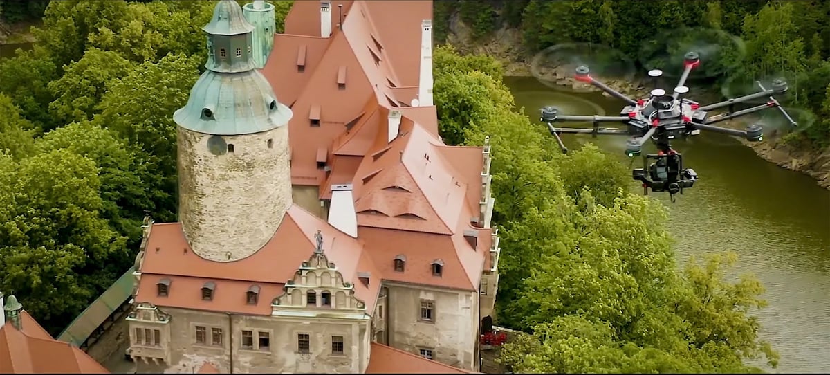
Although how you take your photos generally doesn’t matter to the software, if you don’t have enough photos from enough angles you can have gaps or missing data. To achieve a high-quality 3D model, the pictures need to overlap by 80 to 90%.
Seasoned pilots understand the flight paths and speed required for accurate aerial photography, but if you intend to use a drone yourself, look for a model with waypoint navigation software or use photogrammetry software, like DroneDeploy, that includes a module for controlling the drone’s flight path.
Features to keep in mind when selecting the best software for your use include:
- Scalability for large datasets
- Hardware acceleration (GPU usage)
- Workflow integration (GIS, CAD, BIM support)
- Export formats and compatibility
- Cloud vs. local processing
- Automation features (like AI masking or classification)
- Licensing model and price
Keep in mind that some software (like Metashape or RealityCapture) offers a lot of depth but may require professional training. Others (like DroneDeploy) are more user-friendly but less customizable. Community support, tutorials, or customer service can help guide new users.
Autodesk ReCap Pro 2027
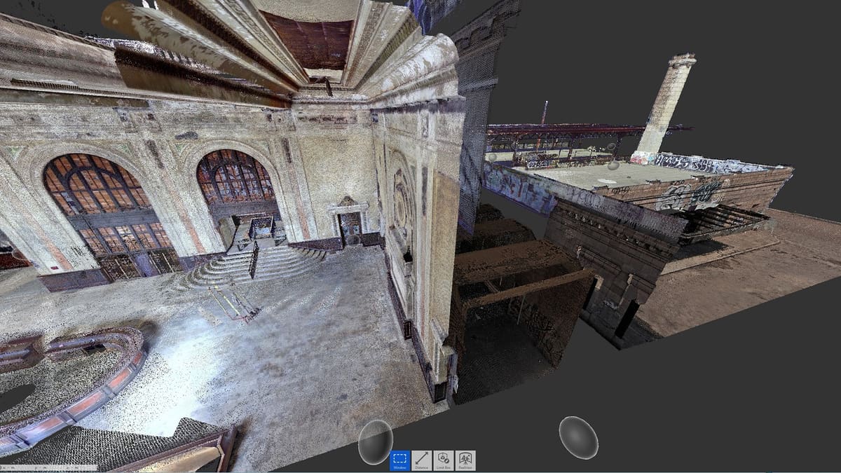
Just like most products from the giant software publisher Autodesk, ReCap is developed for integration into workflows that rely on multiple tools — ReCap is short for “reality capture,” by the way.
You can export the result of your photo captures as a point cloud or mesh into CAD (computer aided design) and BIM (building information management) software, such as Autodesk AutoCAD or BIM 360. The software has two basic modes — one for aerial photogrammetry and another for close-range photogrammetry. In addition to photographs, ReCap can also process laser scans and align them with photo-based projects to generate 3D models.
ReCap Pro 2027 brings five new features to the software. Autodesk Assistant, currently in tech preview, is an AI-powered support tool built directly into ReCap Pro — you can ask it questions about features or troubleshoot design challenges without leaving the workspace. The ReCap home page has been redesigned to make it easier to view and manage your models, with learning content built in to help new users get started.
On the capture side, level panoramic images applies an upright adjustment to non-horizontal panoramic images on import, correcting for scans that weren’t captured perfectly level. For teams working across desktop and cloud, syncing cloud projects to ReCap Pro lets you synchronize annotations, scan groups, and view states from cloud-based projects in Forma Data Management to local projects, so nothing gets out of sync between team members. Finally, ReCap Viewer point display density gives you control over how densely point clouds render — turn it up for visual clarity, or down to improve navigation performance on large datasets.

Metashape
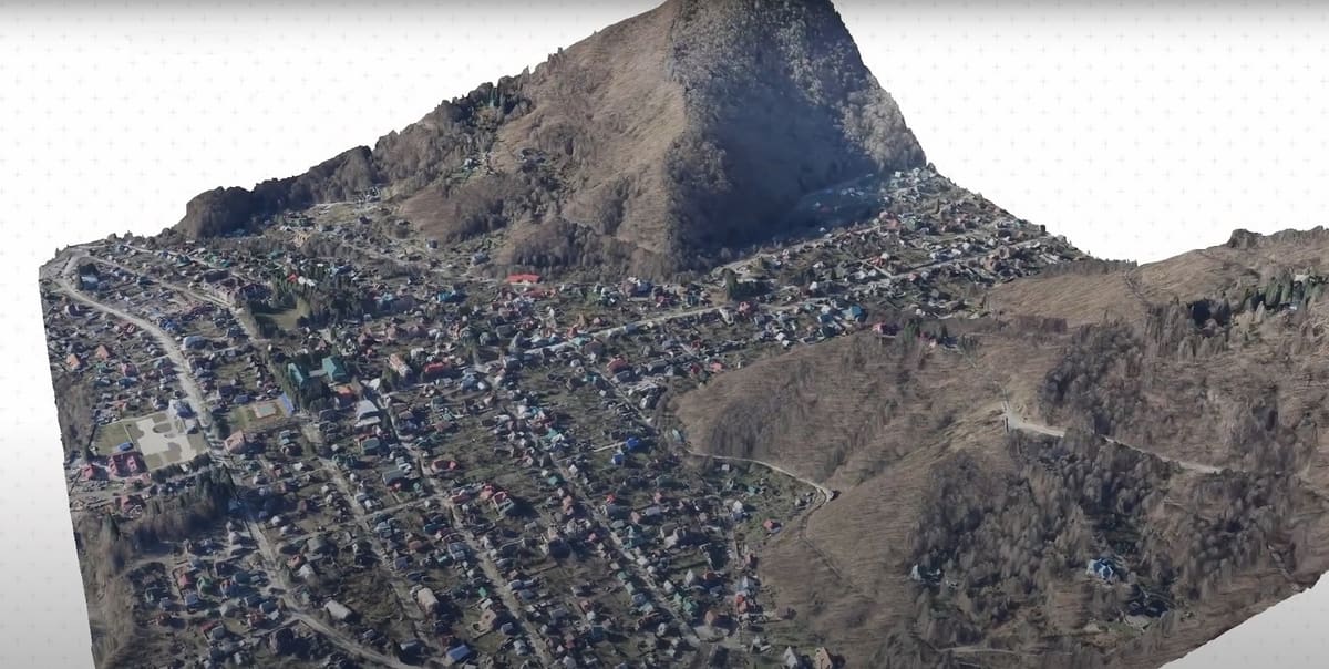
Agisoft Metashape – formerly known as Agisoft Photoscan – is a professional photogrammetry software and a popular choice for GIS applications, cultural heritage documentation, game development, and visual effects production. It is suitable for both close-range photogrammetry and aerial photogrammetry.
The program includes comprehensive tools for editing the point cloud before generating a 3D mesh. This includes automatic classifications of point clouds to customize geometry reconstruction. Meaning, the photogrammetry software can distinguish between diverse objects like buildings and trees, allowing you to filter them.
Metashape improves the processing time and quality of captures over previous iterations, using community-driven data to improve algorithms and machine learning. Over time, in theory, it will continue to improve the more the program is used. It doesn’t directly use all user data to train its algorithms (like cloud-based AI platforms do), instead, individual users can train their software based on their own datasets.
Also, extensive measurement tools enable mining companies, surveyors, and others to conduct volumetric measurements. Among the other stunning features is the possibility of editing 4D models, which means entire scenes can be recorded in 3D and manipulated. The term “4D models” in photogrammetry typically refers to 3D models over time (i.e., time-series data). Metashape supports processing time-series image sets (e.g., for monitoring changes or dynamic scenes), but it’s not a full-fledged 4D animation or simulation platform.
RealityScan 2.2
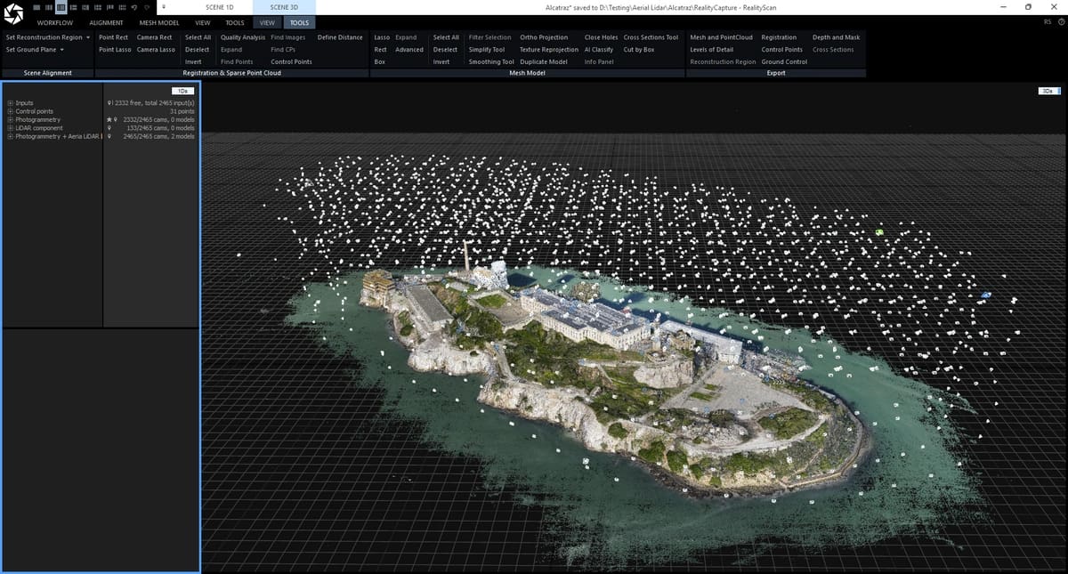
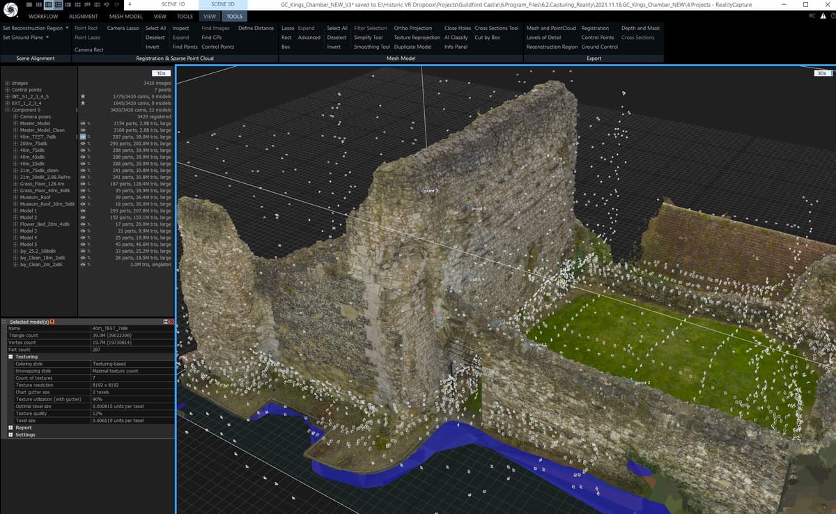
In 2021, Epic Games bought photogrammetry software company Capturing Reality to incorporate its technology into its Unreal Engine, which is used to develop some of the world’s best-known games, like Fortnite. In June 2025, Epic rebranded the desktop application as RealityScan, consolidating it under the same name as its companion mobile capture app, RealityScan Mobile. If you know it as RealityCapture, that’s still the same tool — just a new name and a faster-moving release cycle.
The software can produce accurate 3D models from a variety of input media and is a favorite among pros in surveying, architecture, cultural heritage documentation, virtual reality, and, of course, game development.
Like the other photogrammetry software on our list, RealityScan uses photogrammetric techniques to reconstruct 3D geometry from 2D images to create accurate 3D models. What sets it apart is its automation. RealityScan enables fully automatic combination of laser scans and photographs. Plus, it boasts really fast processing speeds and batch processing capabilities that let you work with large datasets — photo data, 3D scan data — to see results quickly.
With RealityScan you can edit 3D meshes in real-time to refine and adjust models during the reconstruction process. Another bonus is the cloud processing service, so you can offload computational tasks to the cloud for increased processing power and scalability.
New in RealityScan 2.x is AI-assisted background masking, LiDAR and SLAM data import, and support for mixing AMD and NVIDIA GPUs on the same machine — a first for the software, which had previously been NVIDIA-only. Epic has also released a free companion tool, Pano2Views, that converts 360° camera footage into a format RealityScan can process, opening the door to single-shot panoramic capture workflows.
When it comes to price there are some important caveats: it’s free for individuals, students, educators, and hobbyists; free for companies earning under $1 million/year in gross revenue; otherwise its $1,250/seat/year for larger companies.
3DF Zephyr (9.0)
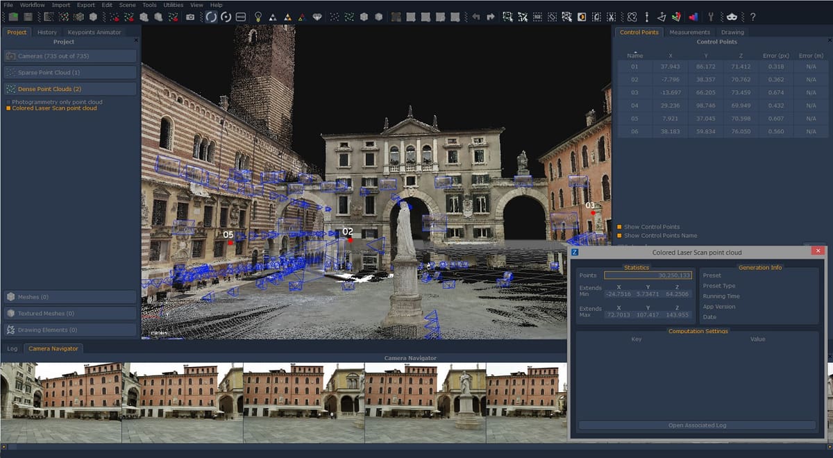
The main reason we like this professional photogrammetry software is that it’s built for user-friendliness. Its user interface lowers the entry barriers for beginners and facilitates generating 3D scans with easy-to-use wizards that explain the process and help choose the right settings. Nonetheless, experienced users can make a lot of tweaks to optimize the result and profit from extensive exporting options into many file formats.
3Dflow’s July 2026 release added 3D Gaussian Splatting support, which is the more genuinely new capability here. Gaussian splatting (a faster, more photorealistic alternative to traditional mesh reconstruction) has been moving from research/NeRF tools into mainstream photogrammetry software over the past year, and Zephyr adopting it is a signal the technique is going mainstream in this category — Bentley’s iTwin Capture Engine also outputs Gaussian splats now.
Like other cutting-edge solutions, we found 3DF Zephyr is capable of aligning photogrammetry data with laser scans. This way, you increase the precision of your 3D model while also retaining the texture maps. Although the usual process is completely automatic, you can intervene manually to work with your scan in a CAD program. 3DF Zephyr enables you to draw shapes using the imagery as a reference. This native CAD model can be sent to programs like Autodesk Revit for BIM (building information modeling).
One of the best things about this photogrammetry software on our view is that you can download a free version and take it for a test drive. The difference between the paid version is a 50-image cap used for the reconstruction and a smaller range of editing tools. Professionals should also check out the GIS and survey tools in the advanced versions.
New in the 2026 release is faster and more accurate structure-from-motion processing, improved mesh quality through photoconsistency-based optimization, and expanded support for 360° camera images. 3DF Zephyr 8.0 introduces several major advancements over previous versions. It adds OpenCL support for Intel and AMD GPUs, expanding compatibility beyond NVIDIA cards. The update brings AI-based automatic classification for aerial photogrammetry, making it easier and faster to process large datasets. An upgraded version of the Masquerade tool includes AI-powered masking, streamlining the object isolation workflow. Photoconsistency algorithms have also been refined for better mesh quality. Zephyr 8.0 improves support for 3DConnexion devices to enhance user navigation and adds native compatibility with formats like Leica LGSx and Teledyne Ladybug, improving integration with professional scanning hardware.
In addition to the annual subscription and the free version, there’s a perpetual license for around $4,500 and a Lite version with limited tools for about $200 a year.
Bentley iTwin Capture WorkSuite
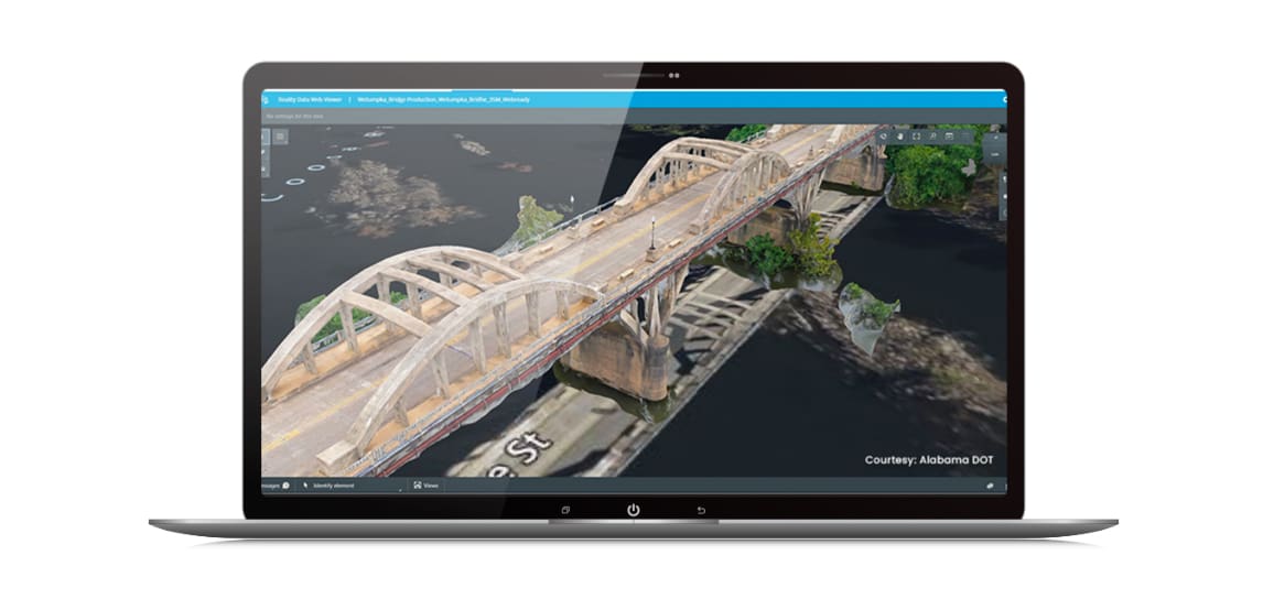
Another major 3D software developer that has published its own take on photogrammetry software is Bentley. In March 2026, Bentley retired its previous desktop offering, iTwin Capture Modeler, and consolidated it into a new product suite: iTwin Capture WorkSuite. The change reflects a shift from a flat annual license toward a pay-as-you-process model built around two components.
The first is iTwin Capture Modeler Flex, a free companion app for preparing and organizing reality modeling projects. It lets you import raw data — photographs or LiDAR point clouds — set up processing tasks, manage project configurations, and monitor progress, whether you plan to process locally or in the cloud.
The second is iTwin Capture Engine, which does the actual heavy lifting: generating high-quality 3D meshes, point clouds, orthomosaics, digital surface models, and Gaussian splats from that prepared data. You only pay when you run a processing job, and multiple engines can run in parallel to speed up large projects. If you want cloud-based processing instead of local, that requires a separate subscription to iTwin Capture Cloud Services.
Given Bentley’s portfolio of sophisticated BIM and CAD software tools for architecture and building, it’s no wonder iTwin Capture WorkSuite can generate 3D models of entire cityscapes — the suite is built for large infrastructure projects and sites of significant scale, and integrates with Bentley’s broader reality and spatial modeling tools for teams managing design, engineering, construction, and operations workflows.
Correlator3D
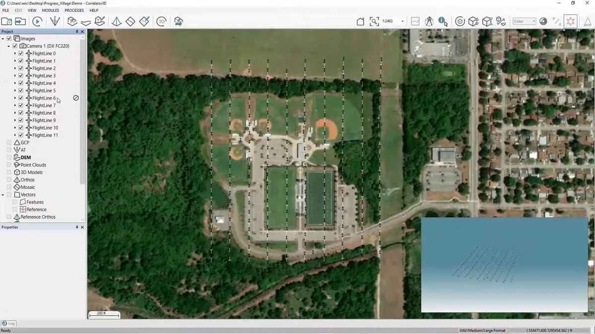
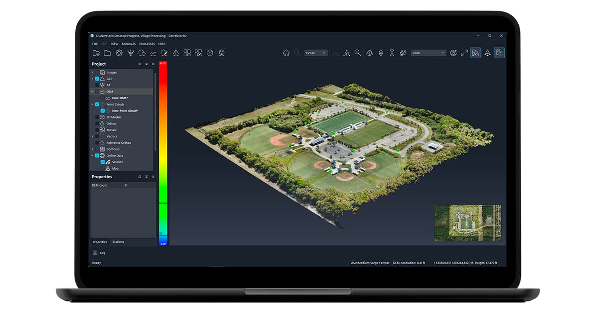
Correlator3D made by Simactive is an end-to-end photogrammetry software package. It focuses on aerially captured images and is equally capable of handling data from drones, aircraft, and satellites. If you are more interested in terrain than the structures upon it, Correlator3D has a powerful automated tool to turn your Digital Surface Model (DSM) into a Digital Terrain Model (DTM). You can also create orthomosaics and 3D models. It can even process multispectral and hyperspectral imagery, enabling users to analyze and extract information from different spectral bands.
You can take your output data and integrate it into geographic information systems (GIS) and computer-aided design (CAD) software for further analysis and visualization.
Used extensively by private companies and governments, it comes with a free trial offer. As a pro software, it comes with deep resources and training opportunities.
DroneDeploy
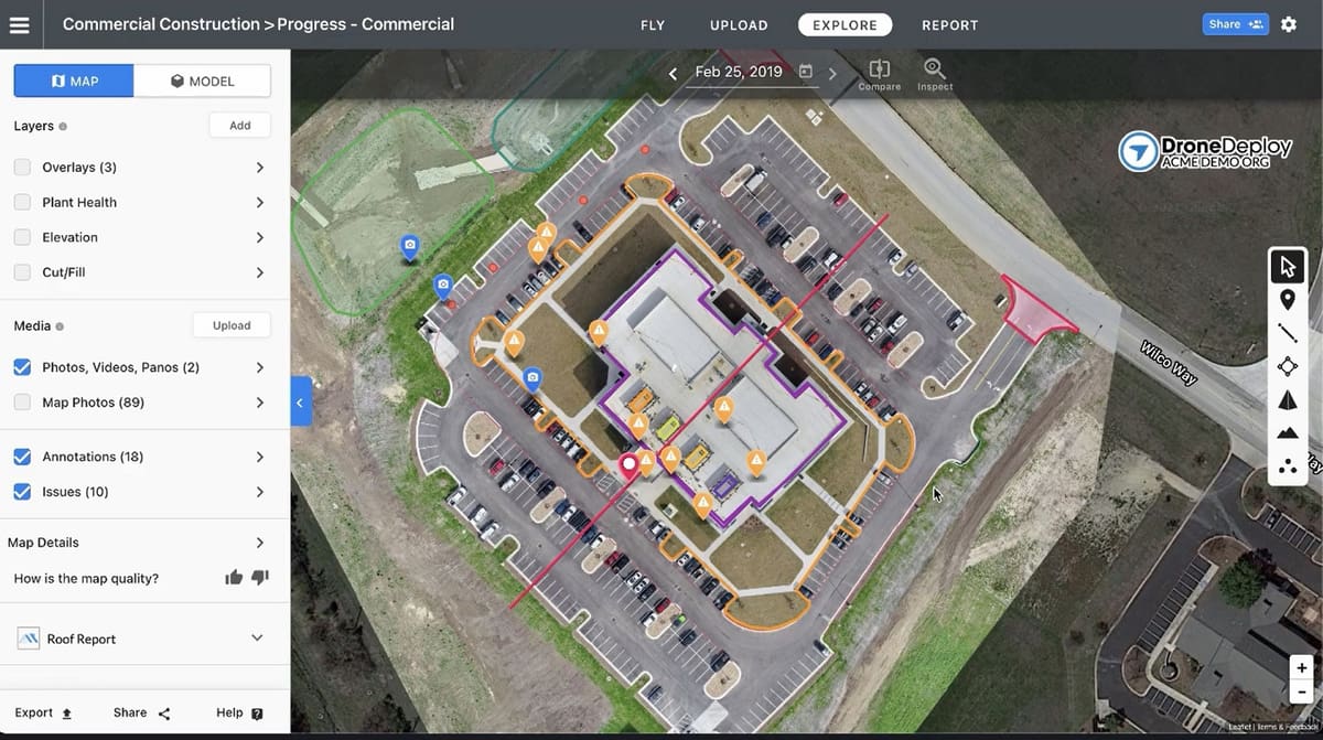
DroneDeploy has grown well beyond its original aerial-only roots. It now covers the entire process from flight to finished 3D model, but it’s rebranded around two core products — DroneDeploy Aerial and DroneDeploy Ground — that can be bought separately or together as a Unified plan.
On the aerial side, a mobile app controls the drone’s flight path: define the area you want to scan on an interactive map, set the direction, and the app handles the flight from take-off to landing. Cloud-based processing then turns the captured images into 3D models and maps, with options for different processing modes depending on your project. You can view results across map layers covering plant health and elevation, and DroneDeploy includes tools for measuring distances, areas, and volumes.
DroneDeploy Ground extends the platform to 360° cameras and ground-level capture, letting you overlay maps onto floor plans, compare site conditions against BIM models, and generate progress reports without a drone at all.
The DroneDeploy ecosystem is no longer DJI-exclusive. Alongside a wide range of DJI drones and docks, it now supports hardware from Autel, Skydio, Freefly, WingtraOne, and select Parrot Anafi models, plus ground robots and 360-degree cameras for site documentation. Add-ons like Safety AI, Progress AI, and DroneDeploy Firewall extend the platform further for construction and industrial customers, and integrations reach into Procore, Autodesk Build, Esri, and several major cloud storage providers.
Imagine Photogrammetry
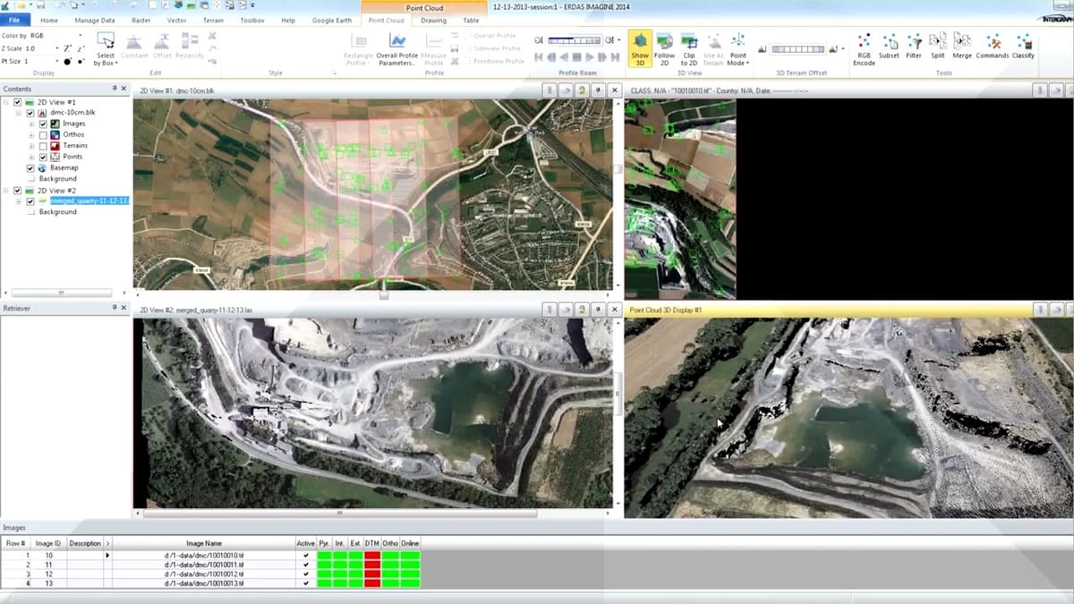
Imagine Photogrammetry from software giant Hexagon is an integrated collection of software tools popular at national mapping agencies, regional mapping authorities, and commercial mapping companies.
Pro features include full analytical triangulation, digital terrain model generation, orthophoto production, and extracting 3D features. By automating precision measurement and including flexible operations such as terrain editing and feature extraction, the solution is flexible enough to fit a wide range of applications.
Hexagon offers an array of add-ons that expand the core functionality of Imagine Photogrammetry, such as a DSM (Digital Surface Mode) Module used for representing the topography or relief of the Earth’s surface; a Spatial Modeler; and a Terrain Editor.
Photomodeler
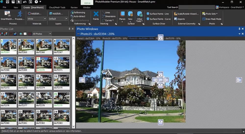
Photomodeler by PhotoModeler Technologies has long been a go-to tool for pros in various industries, from engineering and architecture to archaeology and forensics, before the rise of today’s affordable 3D scanning equipment because you only need a camera. But even now, it is still incredibly useful due to its precision. You can also import LIDAR and point cloud data to extract key evidence from your photos.
PhotoModeler software extracts measurements from photographs taken with an ordinary camera, but you can also feed it drone and video footage. It’s a low-cost way to achieve accurate 2D or 3D measurements and reality capture.
Inside the photogrammetry software, you can choose between three methods to generate your model: manually match common features between images, automatically generate a 3D model from coded targets, or generate point clouds from overlapping images.
The standard version of PhotoModeler contains the core functionalities and is best suited for manual, CAD, and single photo projects. The premium version adds UAS comparability to support drone-taken imagery and integrate 3D laser scan data, among other features.
WebODM
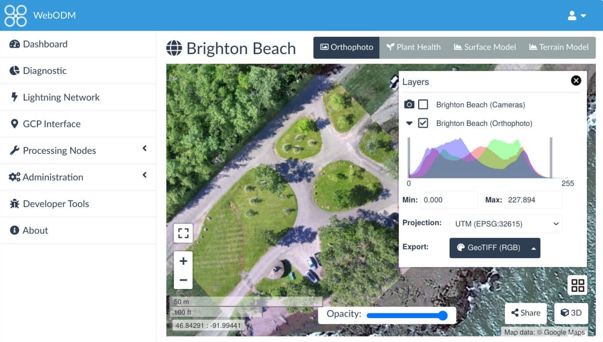
If you’re looking to get your feet wet in aerial photogrammetry with, say, your own drone, take a good look at WebODM. The folks at OpenDroneMap created WebODM to be an accessible and user-friendly platform. Upload your drone imagery, and the software takes care of the almost all of the processing steps. WebODM is a popular open-source photogrammetry software, frequently used for drone mapping. It’s a good choice for users seeking a cost-effective option that can be run on local servers.
You can produce elevation and textured 3D models, geo-referenced maps, and point clouds. It can be used on your computer offline or loaded to servers to use from the cloud, and you can export your elevation contours to the likes of AutoCAD, ShapeFile, and more.
The Software is open source, and you can download it from the GitHub page for free. Some command-line skills are required, though, to get it running. If you want a more accessible entry to the software and customer support, you can also purchase a perpetual license for $57 that comes with an installer.
How to Learn & Master Photogrammetry
As drones, scanners, and software become more accessible and available, the field of photogrammetry is booming. From law enforcement to land management, urban planning to climate science, photogrammetry coupled with other types of data is rapidly advancing these disciplines.
There’s more to mastering photogrammetry than software and drones. You’ll need a solid foundation in camera geometry, image matching and triangulation, various sensor and data types, plus understanding point clouds and their applications.
If you’re not in a position to take a university course on photogrammetry, you could try these online courses below.
Recommended Online Courses
- Introduction to Photogrammetry by EpicGames
- Advanced Photogrammetry and Mapping with UAS Certificate from Michigan Tech University
- Start a drone business – Aerial Photography and Mapping at Udemy
- Photogrammetry With Drones: In Mapping Technology at Udemy
- Photogrammetry for Product Design and AEC at LinkedIn Learning
- Master 3D Reconstruction with Advanced Photogrammetry by 3D Geodata Academy
- Pix4Dmapper Essentials certification at Pix4Dmapper
License: The text of "Our 10 Favorite Photogrammetry Software Tools & How to Pick the Right One" by All3DP Pro is licensed under a Creative Commons Attribution 4.0 International License.
CERTAIN CONTENT THAT APPEARS ON THIS SITE COMES FROM AMAZON. THIS CONTENT IS PROVIDED ‘AS IS’ AND IS SUBJECT TO CHANGE OR REMOVAL AT ANY TIME.